Szczerze mówiąc, złapałam się na tym, że codziennie rano zaglądam do VolcanoGridX zanim jeszcze wypiję kawę 😊 Aplikacja do śledzenia wulkanów — brzmi niszowo, prawda? A jednak wciągnęła mnie bardziej niż się spodziewałam. To co mnie urzekło od pierwszej chwili, to interfejs — ciemny motyw, piękne karty z informacjami, czytelne …

VolcanoGridX App
3.50 (2 reviews)On this page
Reviewed by
Ludis.app Team
Published
May 13, 2026
Updated
May 13, 2026
VolcanoGridX is a mobile app built for anyone drawn to the raw power of Earth's volcanic activity. It brings together a worldwide database of volcanoes, historical event records, and a built-in prediction engine — all wrapped in a dark-themed interface designed to feel as dramatic as the subject matter. From casually curious readers to dedicated trackers who want to bookmark specific volcanoes and log their own observations, the app covers a wide range of engagement levels. It's the kind of tool that rewards both a five-minute browse and a deep dive into decades of eruption history.
App in Action
Inside the App
VolcanoGridX organizes its content around individual volcano profiles, each presenting coordinates, elevation, type, last recorded activity, and a short descriptive overview. The screenshots show entries for Mount Etna in Sicily — listed at 3,357 m, classified as a Stratovolcano, with activity recorded as recently as 2024 — and Eyjafjallajökull in Suðurland, Iceland, standing at 1,651 m and last active in 2010. Both profiles carry status badges: Etna is marked ACTIVE / CRITICAL, while Eyjafjallajökull shows DORMANT / MODERATE. Each badge reflects a numerical threat score displayed through a circular progress indicator.
The Prediction Engine and Timelines
A dedicated Prediction Engine (currently at model version v0.4) sits inside each volcano profile, providing a risk assessment on a scale from Low to Critical. For Etna, the engine flags "multiple warning signals aligned — imminent activity is plausible." For Eyjafjallajökull, it reads "background activity within normal range; monitoring recommended." Alongside this, the Event Timeline section logs historical events with dates, severity labels (Minor, Moderate, Severe), and short descriptions. Etna's timeline reaches back to December 1991, with entries including a magnitude 4.8 Christmas Eve tremor in 2018 and a summit paroxysm in July 2024 that closed Catania airport. Users can also tap Add Log to contribute their own entries.
Facts, Stats, and Navigation
Each profile includes numbered unique facts — the Etna entry notes that UNESCO designated it a World Heritage Site in 2013, with documented eruption history spanning over 2,700 years. Navigation runs through three tabs: Explore, Tracked, and Stats, with a bookmark icon available on each profile for saving favorites. The overall design uses a dark background with white text, status badges in orange and red, and color-coded severity indicators throughout the timeline.
The threat level system leans heavily on color — red for critical, orange for moderate — and while text labels are present, users with red-orange color vision deficiencies may find the visual hierarchy harder to parse at a glance. It's a known accessibility gap in an otherwise well-structured interface.
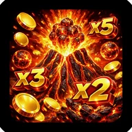
The Volcanic Aesthetic — and a Game That Shares It
The app's dark palette, glowing circular indicators, and lava-orange accent tones share a striking visual language with Coin Volcano — a slot game built around the same erupting-mountain aesthetic. Where VolcanoGridX renders threat scores through slow-building circular rings and color-coded severity, Coin Volcano channels that same tension into spinning reels set against a backdrop of molten rocks, lightning bolts, and flowing lava streams. Both use deep purples and electric oranges to frame their volcanic landscapes. The emotional register — that sense of unpredictable natural force about to release — translates from one screen to the other with surprising coherence.
App Specifications
Platform
Mobile (iOS)
Interface Theme
Dark-themed
Navigation Structure
Three-tab layout: Explore, Tracked, Stats
Prediction Engine Version
v0.4
Threat Level Scale
Numerical score 0–100, ranging from Low to Critical
Volcano Activity Statuses
Active, Dormant
Event Severity Levels
Minor, Moderate, Severe
Volcano Data Fields
Elevation, type, coordinates, last activity year, activity status
| Platform | Mobile (iOS) |
| Interface Theme | Dark-themed |
| Navigation Structure | Three-tab layout: Explore, Tracked, Stats |
| Prediction Engine Version | v0.4 |
| Threat Level Scale | Numerical score 0–100, ranging from Low to Critical |
| Volcano Activity Statuses | Active, Dormant |
| Event Severity Levels | Minor, Moderate, Severe |
| Volcano Data Fields | Elevation, type, coordinates, last activity year, activity status |
About VolcanoGridX
What kind of volcanic data does VolcanoGridX provide for each volcano?
Each volcano profile includes details such as elevation, volcano type, geographic coordinates, last recorded activity year, and current status. Profiles are also enriched with unique historical facts and descriptive insights — for example, Mount Etna is noted as Europe's tallest active volcano with over 2,700 years of documented eruptions.
How does the Prediction Engine assess volcanic risk?
The built-in Prediction Engine (Model v0.4) evaluates warning signals and assigns a numerical threat score along with a status level ranging from Low to Critical. For instance, Mount Etna receives a score of 100 marked Critical with the note "Multiple warning signals aligned. Imminent activity is plausible," while Eyjafjallajökull scores 46 at Moderate with background activity described as within normal range.
Can I add my own event logs to a volcano's timeline?
Yes, VolcanoGridX allows you to log your own entries directly onto a volcano's event timeline using the Add Log button. This lets you build a personal volcanic record alongside the app's pre-loaded historical events, which are displayed chronologically with dates and severity labels.
How are volcanoes organized and navigated within the app?
The app uses a tab-based navigation system featuring Explore, Tracked, and Stats sections. You can bookmark volcanoes you want to follow, and access advanced statistics and activity trends through the dedicated Stats tab.
What severity levels does VolcanoGridX use to classify volcanic activity?
The app uses color-coded severity labels — Minor, Moderate, and Severe — to categorize individual timeline events for each volcano. At the profile level, volcanoes are assigned overall status badges such as Active or Dormant, and a circular visual indicator displays the current numerical threat score at a glance.
Reviews (2)
View allLog in to write a review
Log in with Telegram
Zainstalowałam VolcanoGridX jakieś trzy tygodnie temu, bo fascynuje mnie wulkanologia i szukałam czegoś więcej niż suche artykuły na Wikipedii — ale czy na pewno ta aplikacja dostarcza to, czego oczekiwałam? Odpowiedź jest złożona, więc spróbuję ją rozebrać na czynniki pierwsze. Po pierwsze baza danych wulkanów jest naprawdę imponująca — mamy …
8 replies
spoko apka... te fakty o wulkanach fajne są no i git
Model predykcji to ŚCIEMA. Etna pokazuje "critical" od tygodnia i nic. Zero wyjaśnienia skąd te dane. Brak kontaktu z supportem — napisałem maila, cisza.
Magda_pyta: czy model predykcji (v0.4) jest wystarczająco dopracowany
Co do modelu predykcji — v0.4 to wersja bardzo wczesna, raczej proof-of-concept niż produkcja. Ciekawe, czy API które zasilają te dane to USGS Volcano Hazards Program czy coś własnego. Jeśli własne, latency aktualizacji może być problemem — widziałem przypadki gdzie wskaźnik "critical" był opóźniony o kilka godzin względem rzeczywistych zdarzeń. To nie jest błąd UX, to kwestia źródła danych.